Ouray, Colorado to Cruiserfest 2015

ttora4runner

Expedition Leader
Trying to decide where to go for vacation this year provided a little difficult as there were a number of locations that I wanted to visit from areas in Colorado, Montana, Washington, Alaska and the spaces in between. In the end I opted to stay in the Colorado/Utah region due to some time constraints and for the first time in a number of years my parents and brother from Arizona would join me for a part of the trip. My plans where based on spending a few days in the Ouray area with my folks then make my way to Cruiserfest 2015 via the La Sal’s and Skyline Drive in Utah.

The start of the trip began on a Saturday. I would come from the Colorado Springs and take Owl Creek Pass into Ouray and get register at the KOA before my family would arrive after traveling 10 hours from Phoenix, Az area.


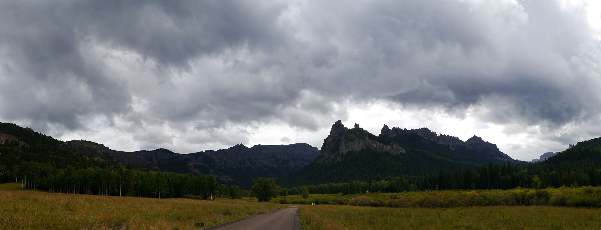
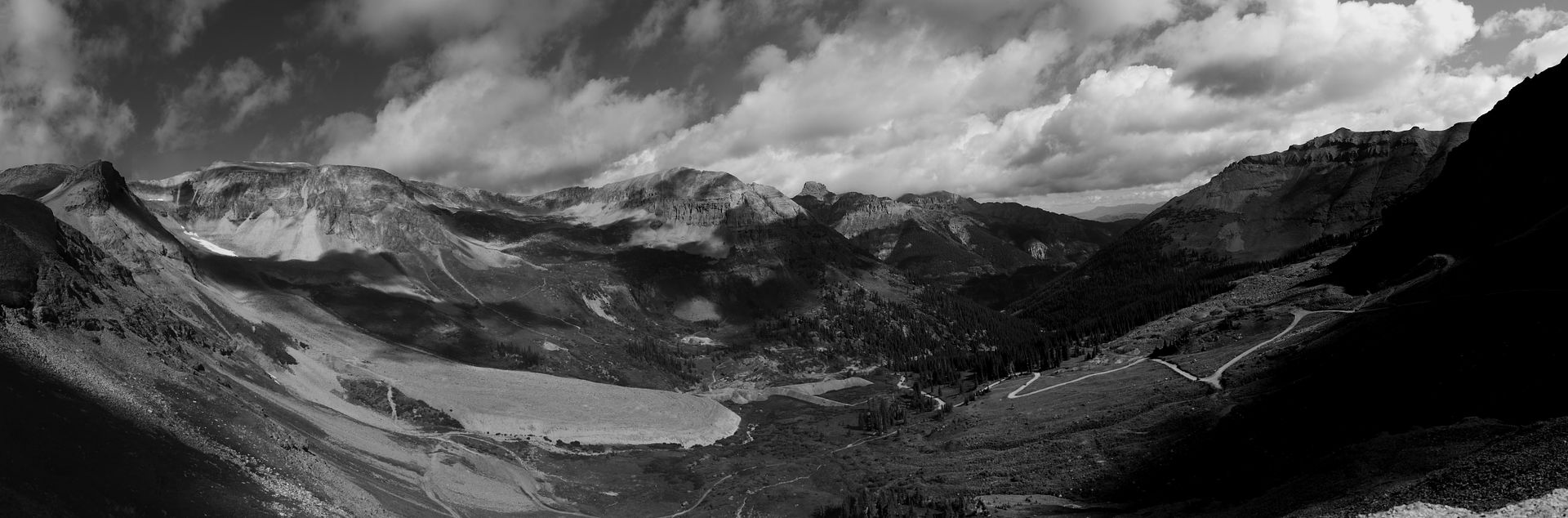
Along Owl Creek Pass

My folks arrived around 5pm at the KOA and we went to work setting up camp. Sometime around 600 pm shortly after we got camp set up it began to rain. Instead of retreating to the tents and/or vehicles to avoid the rain tarps where strung up on the inside of the dinning canopy to give us a rain free area to cook and sit. We would ultimately spend the remaining nights here after the fire had gone out playing cards and mocking one another as we played. My mother who doesn’t play cards got a kick out of us mocking one another and making shadow puppets on the wall.

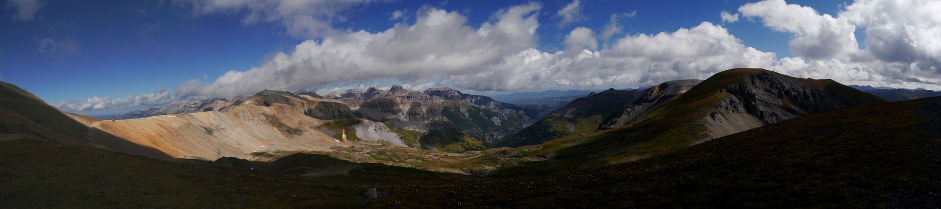
Sunday morning arrived and after making a breakfast I would take my folks and brother to highest drivable pass in the area Imogene Pass and to explore the mining museum in Telluride. This would be the highest point that my family had traveled to (I’ve made this trip a couple of times in the past).


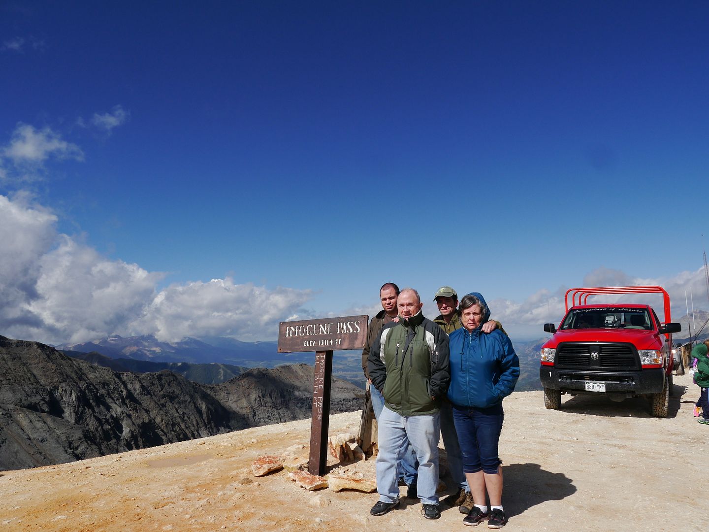
The top of Imogene Pass with my parents and my brother. I'm the dork with the hat on.
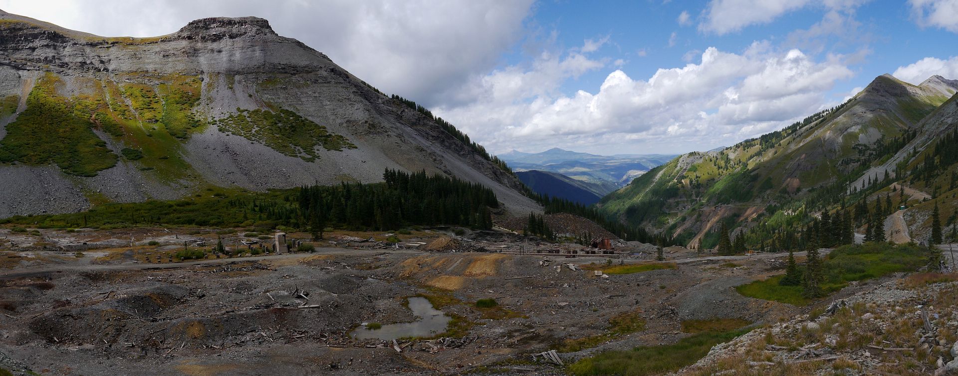
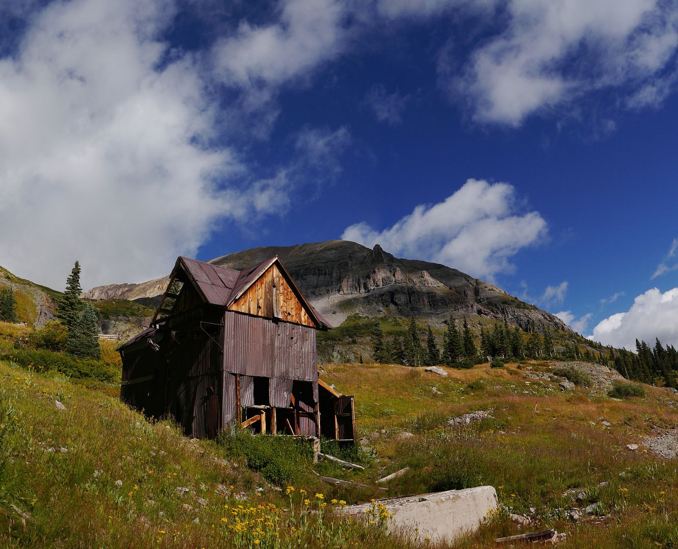
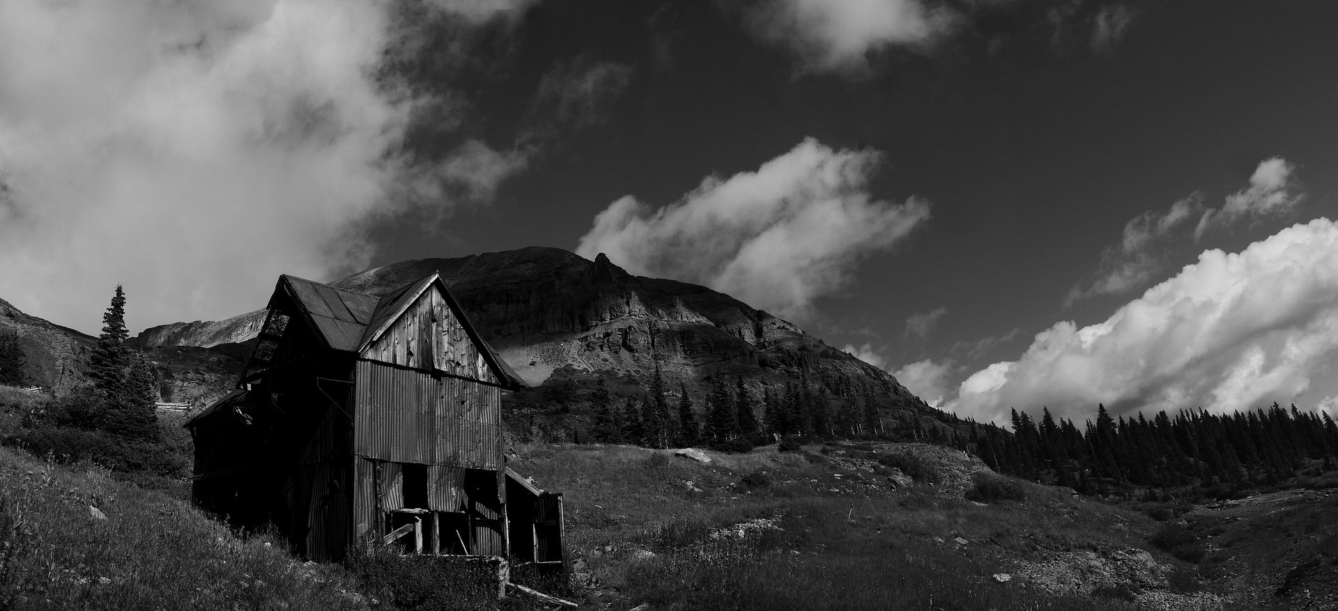
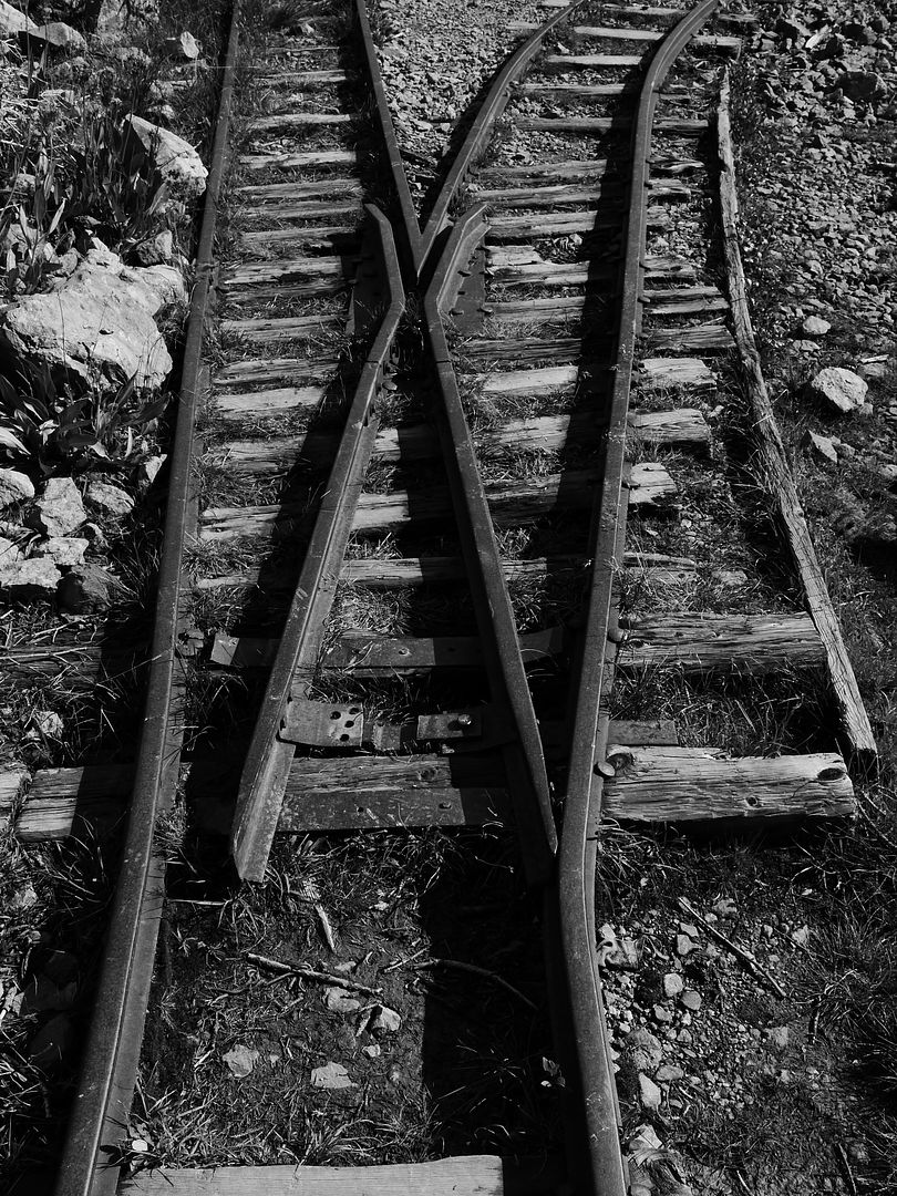
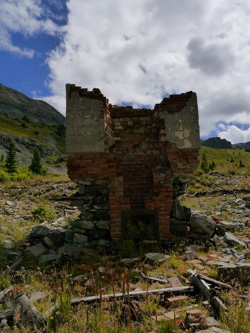

Tomboy mining area


After coming down the pass we stop in the town park for lunch and to just get out of the car. I’m sure my mom was glad to get off the mountain after having a couple of tight squeezes with other folks coming up the single lane road. After lunch I took my folks over to the end of Black Bear Pass trail (my mom probably would’ve disowned me had I taken her on that trail) to see Bridal Vail Falls and then back into town to museum. The local museum doesn’t allow you to take photos but viewing all the exhibits in the 2-story building was worth and gave you a good perspective as to those whom lived there went though. After that it was back to camp for dinner and more card playing.
 
Last edited:

ttora4runner

Expedition Leader
Monday we headed down to the Durango Area to the train museum but not before stopping off to see the old site of Ironton, Silverton to see the mining museum (lots of exhibits, worth the visit) and Little Molas Lake to have some lunch. Since my father wound up with a slight case of elevation sickness from the previous day this was a wise chose.

Ironton Town Site (I have other photos from the first time I visited the area)


No photos from the Museum

Little Molas Lake


Durango Train Museum


ttora4runner

Expedition Leader
Tuesday I had planned to take my parents and brother over Engineer and Cinnamon Pass but due to construction along the road it wasn’t possible. So I took them back up Yankee Boy Basin to Governor Basin and along with a quick visit to Sydney Basin.


After taking in the views we headed back to Ouray and paid a visit to the museum which was well worth the visit to see and learn about some of the history of Ouray itself and the area. It was then back to camp to try and figure out what to do for the rest of the day. We opted to visit ‘Box Canyon Park’ an area I hadn’t visited despite visiting Ouray a couple times before.


Water pouring into the canyon


My brother and I made the short hike up to perimeter trail while my folks went back to beginning of the trail and watched the chipmunks and birds eat at the feeders that were setup. It was quite entertaining to watch after coming back down from the hike.


Come Wednesday morning my parents and my brother packed up and headed back to Arizona. Where I would stay behind and attempt to hike another 14’er Mt. Sneffels at the end of Yankee Boy basin. I had first found Mt. Sneffels on my second visit to Ouray but really pay too much attention to it at the time as I found the area towards the end of my first day in the area. Since I knew I was coming back to the area for this trip I opted to try and make the hike.

I parked near the one trailhead, the one with the outhouse and hike up the road to reach the actual trailhead (which ended up being a good thing). Which I believe is called the ‘Lavender Couloir’ a steep loose rocky ascent and descent. A couple of weeks prior to this trip I had suffered some unexplained chest pain (still no explanation as to what it is) which started to nag me again on the ascent. Ultimately, I decided not to push it and called it quits once I reach the saddle somewhere around 13,600’ if I remember.


The goal was the top of the summit here with one more debris field to hike up.

Before heading back down I was able to grab a couple of photos from the area and despite not being able to reach the summit the views where still great. During this time I also had a nice chat with a lady from Telluride on a guided trip with her husband. She opted to stay behind while her husband and the guide made the rest of the trip to the summit. The conversation essentially centered why the hike 14’ers when there are other places to visit. What came to mind was the since of accomplishment and views. I mean where else can you feel like you’re on top of the world.


After chatting for a bit I head back down the mountain on an equally as steep route but with better footing. After reaching my vehicle I grab some lunch while taking in the cool breeze and the sound of the water coming down the stream. I had planned to hike a portion of the perimeter trail closer to town but someone stopped me near the bottom and noted that I had something hanging from the bottom of my car. Playing it cool I said I had known about it and wasn’t worried about it. As soon as he went around the bend I quickly got out and looked under my vehicle only to find that I lost one of the bolts to my rear trac bar somewhere along the way. Well, ‘CRAP’ what do I do now? I looked though my tool bag to see if I had any bolts that would suffice as a replacement but as luck would have it I didn’t. I had thought about taking a bunch of zip ties and using them to secure it till I could find a bolt but then what about the rest of the trip. So I headed to one of the local repair shops to see if they had a bolt that would fit. After fooling around for a bit with different bolts and $20 dollars later I had a bolt that would suffice till I could get the appropriate one.

With that in hand I went back and hiked a small portion of the perimeter trail then back to the KOA to do some laundry and relax.
 

ttora4runner

Expedition Leader
Thursday morning came and I packed up camp (KOA was nearly void of anyone) and headed off to my next destination Mt. Peale in the La Sal mountains of Utah (the highest point). When planning this trip I had tried to figure out various places to visit and having wanted to explore the La Sal’s for a while it seemed like the most logical choice and I could then take La Sal pass down into Moab.

Upon arriving at the trailhead I reviewed my maps and headed off. I knew that finding the route wasn’t the most straight from what I could find when researching the area but I was still unable to locate any trail that looked like it head up the mountain so I stopped and headed back to junction with Mt. Tukuhnikivatz trail (3rd highest point) and headed up as that route was more traveled.

At the end of the trail you reach a cairn and the saddle between Tukuhnikivatz and Peale. The route up is via a steep talus slope and a faint trail system till you reach the top where you hike along the ridge line till to reach the end of the trail a great view of the Moab area.


Mt. Tukuhnikivatz on the left and Peale on the right.


The Moab area from Mt. Tukuhnikivatz

After spending sometime up here and taking it all in I headed back down the trail to drive La Sal pass down to one of the campgrounds in the area for the night. I thought I had research the area in sufficient detail before coming but I wounded up a little lost at the get go as I failed to see the turn that takes you over the talus slope. I did find the talus the slope but a carbonite trail marker I found didn’t match any of the markers that I was aware of and already having a temporary vehicle repair I turned around and went back the way I came. Looking at it again when I returned home I was indeed on the right trail despite what that sign said.


I ended up staying at the KOA again in Moab instead of backing tracking to the campground I had originally planned on staying at.

Friday would be the longest time I would spend on a dirt road traversing Skyline Drive from exit 72 from I-70 to Tucker, Utah. In 2009 I had driven this trail a couple of times would bale off at the Salina turn never fully completing the route so know I can say I’ve completed the route.


Fall colors along the southern end of the trail


Just past the Salina turnoff


Stopped for lunch hear. The last time I visited this area I camped here.


The highest point on Skyline Drive


View of the Seely Creek Guard Station, always wanted to see it. So I did.


Fall colors towards the end of the trail.

I ended up making from Moab to Spanish Fork before filling up with gas, pushing it a little.

Friday night I opted to stay in a hotel in Lehi, Utah and a real bed after spending a few nights camping.
 

ttora4runner

Expedition Leader
Saturday morning I would make my way over to Tooele and to Cruiserfest 2015. Just a couple of photos of some of the Landcruisers there. I really don't have much to say on the event besides that it was good meeting up with old friends and sitting though some of the presentations.


After spending the day at the event I was back to hotel for the night. Sunday morning I would meet up with an old friend from Missouri and his family whom has been living in Utah for the past few years for breakfast before making the trek back to Colorado Springs via Wyoming.

In the end it was a great trip meeting up with old friends and seeing some great scenery but I think the best part was getting able to share some of this experience with my family.


Despite the lost bolt to trac bar my vehicle performed great on the trip and would end up spending the next month covered in bugs, dirt and grime as I continued to travel on the weekends to various trails in Colorado.
 
Last edited:

Funrover

Expedition Leader
Heck yeah. looks like a wonderful time had by all!! Always good to see family and explore!
 

boyfester

Observer
Great photos! Ouray is such a beautiful place. I drove through there this summer but was only able to stay a couple of days. I could easily stay a week.
 

Pitchpt

Observer
Thanks for sharing, love your photos. We were at Cruiserfest 2015 as well. Make no mistake, the event was great, but the adventure of getting there was the best part.
 

nmatcek

Adventurer
Great trip report. Thanks for sharing. One thing I realized as I get older is that I really took all the little camping trips as a kid with my family for granted. Maybe "taken for granted" is the wrong phrase, maybe I just appreciate it much more now looking back. I'm glad you were able to enjoy traveling with your family. Cherish those times! I know I do!

Sent from my HTCONE using Tapatalk
 

Forum statistics

Threads
187,463
Messages
2,894,817
Members
228,400
Latest member
rpinkall1
Top